Escape from Creek Fire
As devastating wildfires rage across California, a group of four friends become trapped in the Sierra Nevada wilderness by the rapidly expanding Creek Fire, and narrowly escape by changing course and hiking over the mountains.
Editors note: this year’s fire season is already the worst on record. Please consider making a donation to your local American Red Cross chapter or disaster relief organization, and please consider voting for representatives who will enact legislation that addresses human-made Climate Change.
FRIDAY
My partner, Lucas, and I parked our car at Red’s Meadow in Devils Post Pile National Monument and departed on a trail that crosses over to the west side of the Sierra. It is a 13 mile trail called the “Mammoth Trail” with about 4,000 feet of elevation change. We carried a week's worth of backpacking supplies on our way to meet two friends, Asha and Stephen, who were waiting for us on the other side at the Mammoth Trailhead in Sierra National Forest.
They drove in from the Bay Area and had quite a night trying to get to the trailhead. Along their drive Asha and Stephen were rerouted due to a bridge being out on the primary way in. Their RAV-4 providing just enough clearance to follow the maze of forest service roads leading to the trailhead.
Lucas and I called it a night along the trail just a few miles from where Asha and Stephen were camped at our meet up spot.


SATURDAY
The next day started out hot. It was 9am and we were covered in sweat as Lucas and I climbed out of the North Fork of the San Joaquin River just two miles from our friends.
We made it to the trailhead an hour later and were greeted by Asha and Stephen with coffee. We dove straight into repacking our gear, dividing up food, and going over our plan for the week.
The itinerary for the day included leaving from the Isberg Trailhead and hiking 13 miles to Lake Catherine which sits on the west side of Ritter Peak. We then would spend the following 8 days summiting mountains, swimming in lakes, and exploring the Sierra Nevada.
This was a trip put together to celebrate Asha’s 25th birthday and we were excited. We loaded up the car and drove a short distance to the Isberg Trailhead to begin our trip.

1PM
A few miles into the hike we became aware of smoke in the air and were not surprised. We had anticipated that. There were wildfires all over California and we knew some would probably blow smoke over where we were at some point of the trip. We hiked for 6 miles before we noticed the black smoke above us.
At 1pm we had just come out of the woods and arrived at an overlook that presented a fantastic view of the West side of Ritter, Banner, and the Minarets. Above us a black plume crawled across the sky and began to thunder. By 2pm the sun disappeared along with our view of the mountains in front of us. We watched and listened as the smoke enclosed around us.


2:40PM
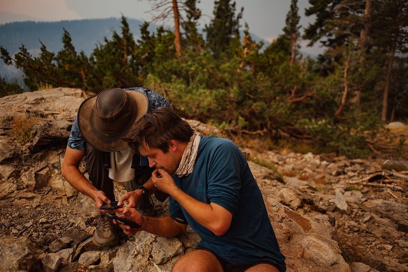
At this point we were using all resources available to decide what to do. Between the four of us we had three inReach devices that were being using to text friends asking for more information—Is this a new fire? Here are our coordinates, should we be concerned by the smoke we see? Does it look like we can drive out? We texted and waited.
Soon news of the Creek Fire trickled in as we sat beneath thunder rolling for 3 minutes at a time. We learned it was indeed a new fire, were given the coordinates of where it started, and a report that the road out was still open. A friend called the ranger station to ask for information on our behalf and after hearing back from the ranger, sent us a text—“If you exit through Red’s Meadow, you should be safe”.
3PM
We decided to turn back, hike to the car at Isberg Trailhead, and try our hand at driving to safety. We assessed that if we couldn’t drive out we could always turn around and hike back to the car Lucas and I had in Red’s Meadow. It wouldn’t be easy or fun hiking in the smoke but we had the resources and it would get us away from the fire.

4PM
The hike back to the car was a blur. We piled into the RAV-4 and started driving. Stephen remembered that the main route on had a downed bridge so we had to retrace directions to the detour he and Asha followed on the way in the night before. We passed a vehicle changing a flat tire with a few other cars stopped waiting for them. Then a caravan of cars speeding the opposite direction passed, honking and flashing their lights at us. We slowed down to try and speak with one of them and no one stopped. We continued down the road waiting to see what was ahead.
Lucas hopped on his phone to work on tracing our route on a map to see how close it might intersect with where we were told the fire was. The estimation he came up with didn't look promising


5PM
By this time it was 5pm and the sky was blood red, the trees looked blue, and everything had a silver glow to it. There was a tinge of panic in the air as everyone seemed to try different ways of escaping. We rounded a bend and found a man pulled over in his pickup truck watching the scene unfold. This was about 3 miles from where the fire was raging at Mammoth Pools Reservoir. The man in the pickup truck who told us he was evacuating from his home “down there” and nodded toward the apocalyptic scene below. “The sheriff called and told me to get out... There are people trapped down there.”
We asked him if there was any way out and he offered a few names of landmarks without much certainty. There was little to no information to go on. He bid us farewell and started to drive back toward the way we came. As a group we discussed the option of continuing down the road to see how far we could get but knowing how unpredictable fire can be made us reconsider driving toward it. We made the decision to turn around and began speeding back to the Mammoth Trailhead.
Again we passed a caravan of 6 or 7 cars going the opposite direction. This time the lead car slowed to speak to us. “Did you hear there is a fire back there?” The man gestured behind him, in the direction we were headed. “Actually the fire is that way” Stephen said and pointed West, where we had just turned around. “Well” the man driving the white SUV replied, “the ranger said to drive this way and if she came back driving the opposite direction, it wouldn’t be safe and we should all turn around.” We all sat there looking at each other waiting for something that never came. Uncertainty filling the silence.
We wished them luck and continued on our way. Each party going in opposite directions. We passed more people leaving from Isberg Trailhead. We discussed trying to find another way out but the roads required high clearance and we didn’t want to risk breaking down on a forest road this close to the fire.

6PM
We made it back to the Mammoth Trailhead by 6pm. At this point we were in robot/survival mode—moving robotically, doing our best to stay present, and trying to continue making the best decisions as we could. We updated our friends via our inReaches with the new plan. We were going to leave Asha’s car and hike back to Red’s Meadow on the Mammoth Trail. We left extra food, supplies, and whatever else we deemed unnecessary behind in effort to make our packs as light as possible for the 13 miles and 4,000ft ahead of us.
The sense of the group was resolute. We were tired from the morning hike, the stress we were living in, and the smoke we were breathing. We had no other option but to continue forward.

6:15PM
It was 6:15pm when we left the car and began our hike. For several hours we walk through waves of exhaustion and nausea. By 10pm we decided to make camp for the night. More texts came through our inReaches and we learned the fire was 10-15 miles west of us and the winds were forecasted to continue blowing that direction throughout the night. We knew that was close and had to keep moving but also needed to rest.
One of the best decisions we made that evening was choosing to only bringing the best snacks and dinner option available. Which happened to be smoked salmon and mussels accompanied by biryani rice. This ended up being just the magic we needed to keep morale up as the evening came to an end. That night we all slept soundly.

SUNDAY
We awoke the next morning at first light. Lucas and I lay in our tent staring at the inside of our rainfly quietly recounting the events of the day before while slowly realizing what the day ahead would entail. We could hear Stephen and Asha moving in the tent next to us. They eventually rolled out first and began to make coffee and oatmeal for everyone.


7AM
When I unzipped the tent I saw white skies with smoke lingering in the trees around us. The smoke felt closer than the day before. Again the pine trees had a blue hint to them, the light cast an odd orange glow over everything, and although the sun was up there were no shadows on the ground

9AM
At 9am we got on the trail refreshed by a sound night of sleep. After an hour of hiking we entered cell phone service and got an update on the fire. It had grown from 1,000 to 36,000 acres overnight at 0% containment, spreading 18 miles west. There are a lot of “what if’s” my mind jumped to with this information. Like what if the winds shifted that night and the fire pushed east, finding us asleep in our tents… but those thoughts had to be put aside. We had to press on.
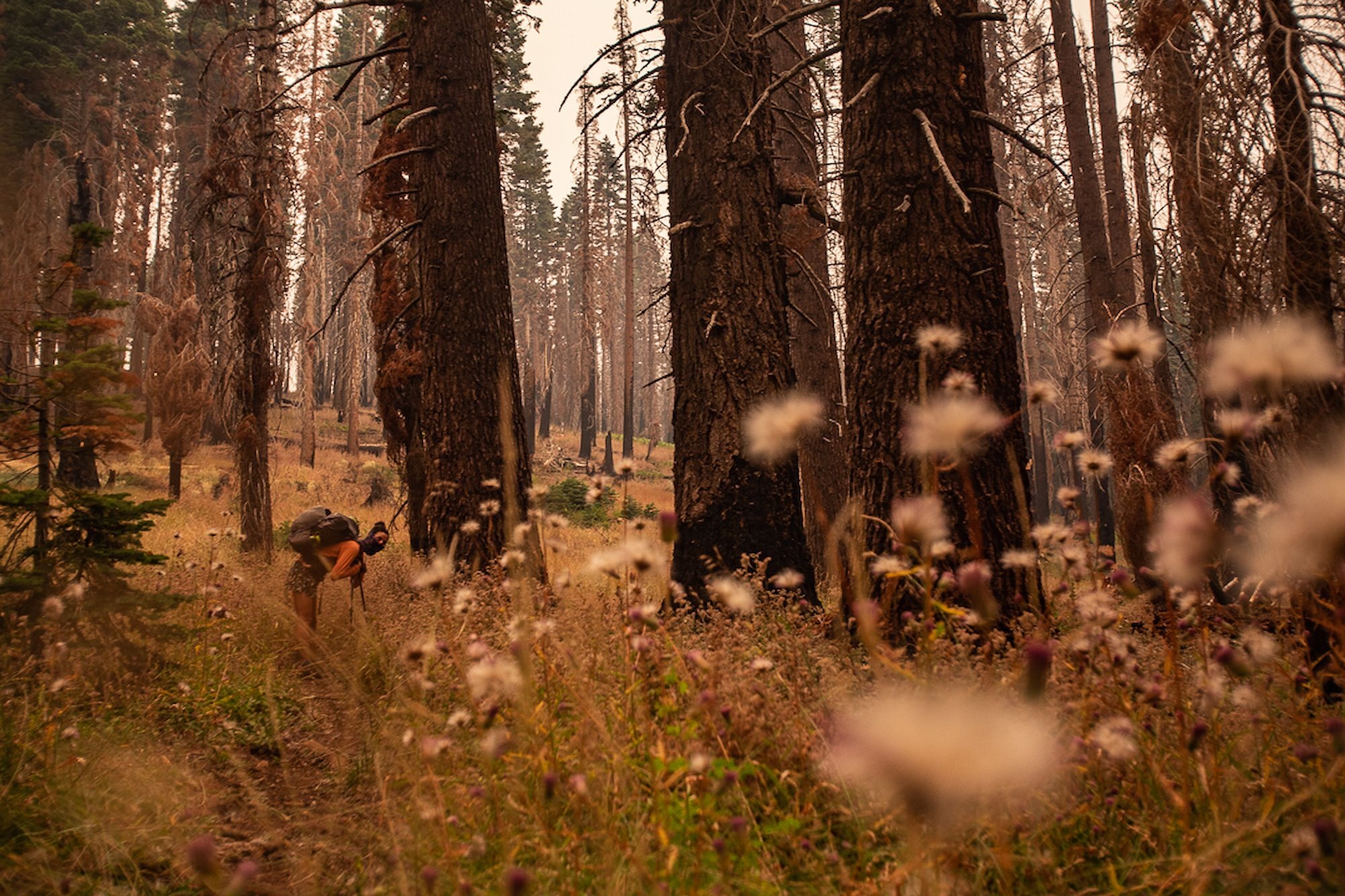
The trail led us through burn scars from a previous fire. The landscape wreaked of fire, smoke continued to follow us, the colors still emanating blue-green’s and golds. I turned to Lucas and said “it feels like the whole forest is holding it’s breath. It’s just so quiet.” He nodded in agreement.

12:45PM
The morale of the group danced up and down as we climbed and descended our way to Red’s Meadow. We made frequent stops to drink water. A few of us got nauseous and had to hike through it. We did our best to stay positive and patient with each other. We checked our phones for more updates and wondered out loud about the people we passed on our way out, hoping they were okay.
We then learned many of the people we passed in caravans had made it out thanks to the National Forest Service and Local Officials guiding them through the scene. This news helped us realize if we did continue forward, we also would have been led away from the fire to safety.


4PM
It was 4pm when we arrived back at the vehicle. We dropped our packs, sat on the ground, and dove into the snacks that were waiting for us in the van. Next as we drove to my home in Mammoth Lakes. We spent the evening showering, recounting the past 48 hours, letting friends and family know we were safe, and watching more information about the Creek Fire trickle in.
That evening the "what if" game crept back in. If we continued driving down that road, would we have ended up at the reservoir along with 200+ other people? Would we have spent the evening in waiting in the water to be rescued by helicopter as we watched the fire surrounded us? Would we have gotten out along the route with the downed bridge?
It was such a relief to learn about everyone who was evacuated safely.

MAP
A quick note: the following is a screenshot of a map we drew once we arrived home to help clarify the events described here. Each number is marking different parts of what unfolded. Here is the key:
We start hiking up the Isberg Pass trail
We arrive at an big overlook and see the plume of smoke forming behind us. We decide to turn around, hike back to the car, and try driving out
We turned around because we met a local who said there were people trapped ahead and saw cars speeding the other direction. We park our car at Mammoth Trail and set out on foot
Exhausted, we make camp around 10pm
The next morning we hike to our car parked at Red's Meadow.